martes, 22 de diciembre de 2020

RECONOCIENDO EL VALOR PAISAJÍSTICO DE NUESTRO ENTORNO. PARTE I


 Comenzamos nuestro proyecto de aula, en el que habrá dos hilos conductores: la fotografía y la aplicación Geocaching. 


El proyecto consistirá en que los alumnos deberán elegir un geocaché localizado en algún sitio que para ellos sea de interés ecológico o paisajístico.

 Cada uno de ellos se dacantará por una localización diferente. Deberá crear una ficha digital con el siguiente material:

-Captura de pantalla de la localización del geocaché.

-Making off de la ruta (vídeo corto).

-Una fotografía que resalte lo valor paisajístico o ecológico de nuestra Reserva de la Biosfera.


Se valorará positivamente las conexiones en sus rutas con contenidos del módulo profesional Repoblaciones Forestales y Tratamientos Selvícolas. Aportando material visual sobre algunas repoblaciones de alcornoques de la zona, correcciones hidrológico-forestales, etc. 


Finalmente y después de exponer todas las fichas en clase, se elegirá la fotografía de la clase que mejor recoja el encanto de los paisajes de La Siberia Extremeña.

PRIMER DÍA DEL PROYECTO.

Descargamos la aplicación Geocaching en nuestros móviles.


sábado, 19 de diciembre de 2020

COLOCANDO EL GEOCACHÉ EN EL PARAJE "LOS BAÑOS"

En la mañana del 19 de diciembre emprendimos ruta para colocar nuestro geocaché en una zona bastante asidua de los lugareños, pero donde apenas se acercan personas ajenas a estas tierras. 

On the morning of December 19, we set out on a route to place our geocache in an area that is quite common among the locals, but where people from outside these lands hardly go.


Comenzamos nuestra andadura saliendo de la localidad de Valdecaballeros en dirección a la carretera que une esta población con la vecina localidad de Guadalupe. Una vez sobrepasamos el límite de la urbanización Los Encinares, nos desviamos por el primer camino situado a la izquierda señalizado con el nombre "Camino Pastera".

We begin our journey leaving the town of Valdecaballeros in the direction of the road that connects this town with the neighboring town of Guadalupe. Once we have passed the limit of the Los Encinares urbanization, we turn off onto the first path on the left, signposted with the name "Camino Pastera".


Debemos avanzar por este camino unos 3 kms. Podemos elegir entre hacer ruta senderista o transitar con un vehículo ya que el camino tiene un ancho aproximado de 5 mts.

We must so along this path for about 3 kms. We can choose between hiking or traveling with a vehicle since the road is approximately 5 meters wide.


Iniciamos la ruta en llanura, donde predomina la dehesa salpicada con grandes encinas. En nuestro camino hacia los Baños prosperan diferentes árboles, arbustos y flores silvestres, entre ellos encontramos cantueso, torvisco, retama, jara, brezo, jaguarzo, tomillo, romero y espino, entre otras especies. A finales del invierno y principio de la primavera, algunas esparragueras.

We start the route in the plain, where the pasture dotted with large holm oaks predominates. On our way to the Baños different trees, shrubs and wild flowers thrive, among them we find lavender, torvisco, broom, rockrose, heather, jagz, thyme, rosemary and hawthorn, among other species. And in late winter and early spring, some asparagus.


A medida que avanzamos comienza una ligera subida, donde observamos bosques de pinos de reforestación entre pequeños pedazos de olivares dibujando hileras rodeadas de mantos verdes con algunas casillas solariegas que sirven de relax y disfrute en plena naturaleza.

As we walk along, a slight ascent begins, where we see reforestation pine forests between small pieces of olive groves drawing rows surrounded by green blankets with some stately homes that are godd to relax and enjoy nature.


Una vez llegamos a los Baños, en lugar privilegiado está situada la Ermita en honor a San Isidro, un poquito más abajo un balneario con aguas medicinales y un lugar de inigualable belleza paisajística que utilizaremos como base para el proyecto a desarrollar por alumnos de 4º ESO del IES Benazaire.

Once we arrive at the Baths, in a privileged place is the Hermitage in honor of San Isidro, a little further down a spa with medicinal waters and a place of incomparable scenic beauty that we will use as a basis for the project to be developed by 4th ESO students from IES Benazaire.


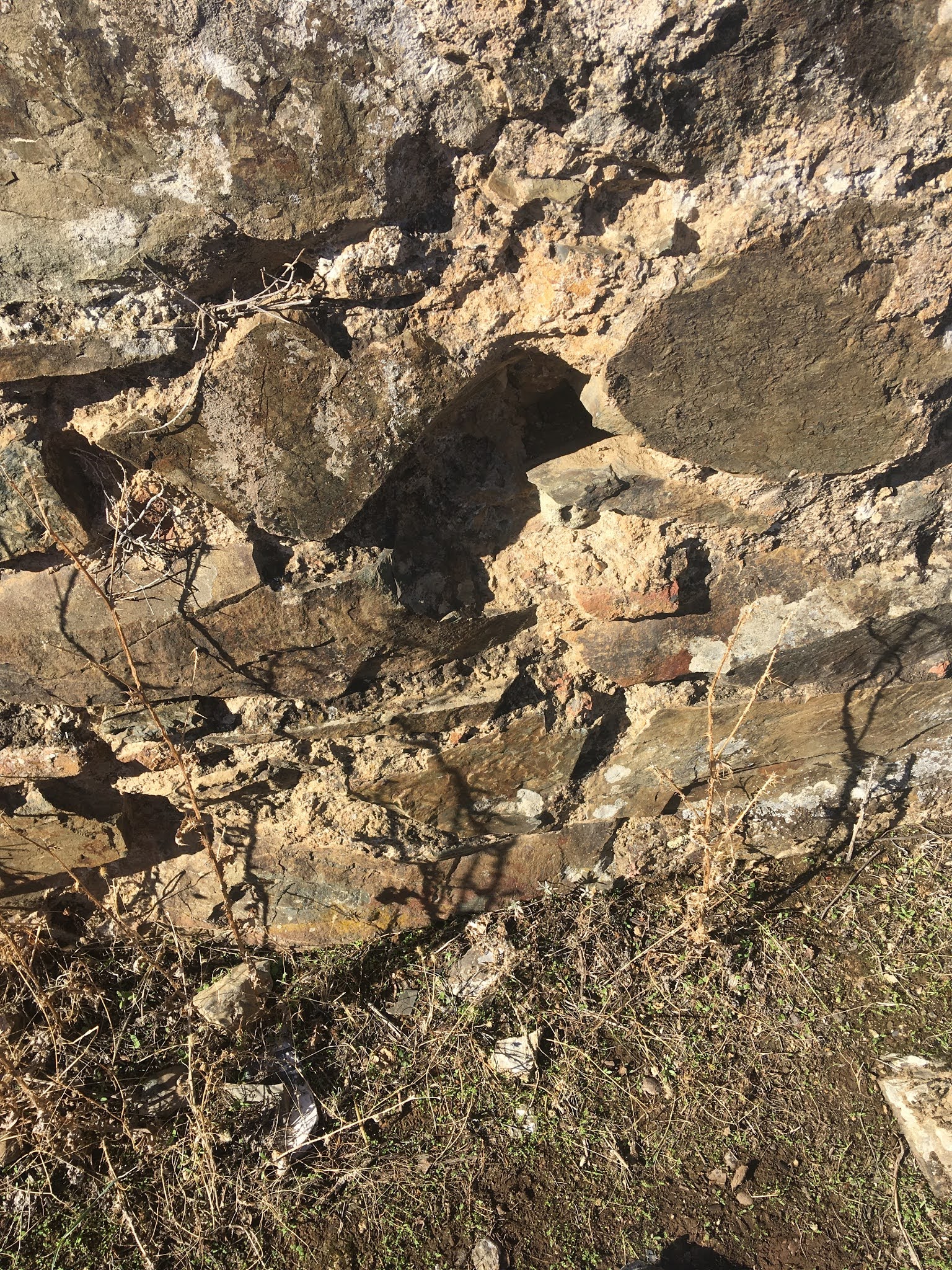
Para esconder el geocaché subimos unos metros por el camino de subida a Pastera, dejando la ermita a la izquierda hasta llegar a la primera intersección de caminos. Justo en ese lugar surge una magestuosa encina debajo de la cuál colocamos el geocaché entre piedras de pizarra propias del lugar.

To hide the geocache we go up a few meters up the path up to Pastera, leaving the hermitage on the left until we reach the first intersection of roads. Right in that place a majestic holm oak arises under which we place the geocache between slate stones typical of the place.

La geolocalización es muy accesible, sin dificultades añadidas. Deseamos que quienes busquen el geocaché disfruten del camino y aprovechen el lugar para descanso, relax y recargo de energías positivas.

Geolocation is very accessible, without added difficulties. We hope that those who seek the geocache enjoy the journey and take advantage of the place to rest, relax and recharge with positive energies.


viernes, 18 de diciembre de 2020

APP IGN PARA LA ACTIVIDAD DE GEOCACHING (GEOCACHÉ LA PARRA)

    La App del Instituto Geográfico Nacional es una aplicación muy útil para la actividad del Geocaching y por ello se está formando a los alumnos de 2º Ciclo Aprovechamiento de Recursos Naturales en el uso de dicha App. Se utiliza,además, en la asignatura "Prevención de Incendios Forestales", para la adquisición de conceptos cartográficos. 

The App of the National Geographic Institute is a very useful application for the activity of
 Geocaching and for this reason the students of the 2nd Cycle Use of Natural Resources are 
being trained in the use of the App. It is also used in the subject "Prevention of Forest 
Fires ", for the acquisition of cartographic concepts.


    Para ello hemos creado el siguiente vídeo explicando los contenidos básicos de la aplicación, para su uso en Proyecto Geocaching Benazaire y en la asignatura de Prevención de Incendios Forestales. 

For this we have created the following video explaining the basic contents of the application,
for its use in the Geocaching Benazaire Project and in the subject of Forest Fire Prevention.


    Para probar y practicar con la aplicación se ha generado un track de la ruta hacia la colocación del Geocaché colocado en el Cerro La Parra. El Track es el siguiente:

To test and practice with the application, a track of the route to the placement of the 
Geocache has been generated on Cerro La Parra. The Track is as follows:


    En la misma ruta se han realizado algunas fotowaypoint (fotos georreferenciadas) de puntos importantes de la ruta. Ejemplo de una de ellas es la siguiente:
On the same route, some photowaypoints (georeferenced photos) of important points of the 
route have been made. Example of one of them is the following:


         Algunas fotos de dicha ruta son las siguientes:
        Some photos of this route are the following:


    El track de dicha ruta en formato gpx se subirá a la plataforma wikiloc para su descarga por parte de los usuarios. El enlace a dicha plataforma es el siguiente:  Wikiloc

The track of the aforementioned route in gpx format will be uploaded to the wikiloc platform 
to be downloaded by users. The link to this platform is as follows: Wikiloc

    Como material didáctico para el uso de la App IGN: Manual IGN

    As didactic material for the use of the IGN App: IGN Manual


jueves, 17 de diciembre de 2020

Geocaching en el "Pico de la Parra"

 Durante la tarde del martes 15 de diciembre llevamos a cabo una ruta para colocar un geocaché en una zona poco transitada, localizada en uno de los caminos que salen desde la pista de la cigüeña, pista que une el cerro del "Cabezo", ubicado en el límite de Herrera del Duque y Fuenlabrada de los Montes, con el centro de interpretación de "Los Robledillos" en Helechosa de los Montes, atravesando entre otras la pista central de la Reserva de Caza de Cíjara.

During the afternoon of Tuesday, December 15, we went to a route to place a geocache in a little-traveled area, located on one of the paths that leave from the stork track, a track that joins the hill of "Cabezo", located in the border of Herrera del Duque and Fuenlabrada de los Montes, with the "Los Robledillos" interpretation center in Helechosa de los Montes, crossing, among others, the central track of the Cíjara Game Reserve.


Una vez finalizada la ascensión, llegamos a una explanada desde donde sale un sendero señalizado con flechas blancas, sendero que se va a utilizar para cruzar la cuerda de la sierra y tener bonitas vistas del embalse de García Sola y el municipio de Castilblanco. Nos encontramos en este punto a 700 metros de altitud aproximadamente. La vegetación que se observa en el recorrido son especies autóctonas como el madroño, la encina, el alcornoque, el enebro y la jara pringosa, y otras introducidas, en este caso mediante repoblaciones, como el eucalipto. Además, se pueden observar ciervos, gamos y algunas especies de rapaces como el buitre negro y leonado.

Once the ascent is finished, we arrive at an esplanade from where a path marked with white arrows starts, a path that will be used to cross the mountain range and have beautiful views of the García Sola reservoir and the municipality of Castilblanco. We are at this point at an altitude of approximately 700 meters. The vegetation observed on the route are native species such as strawberry tree, holm oak, cork oak, juniper and sticky rockrose, and others introduced, in this case through repopulation, such as eucalyptus. In addition, you can see deer, fallow deer and some species of raptors such as the black and griffon vulture.


Para la colocación del geocaché se utiliza como referencia una de las flechas blancas del sendero, ubicada cerca de una oquedad en la que existen algunas especies de brezos. Toda la ruta ha sido realizada por varios compañeros del IES Benazaire y en la parte alta del Pico de la Parra, donde se ubica el geocaché, se realiza una grabación explicativa.

For the placement of the geocache, one of the white arrows on the path is used as a reference,located near a hollow in which there are some species of heather. The entire route has been walked by several colleagues from IES Benazaire and in the upper part of Pico de la Parra, where the geocache is located, an explanatory recording was made.


martes, 15 de diciembre de 2020

COLOCACIÓN DE GEOCACHÉ EN PISCINA NATURAL "PRETURA DEL MOLINO" FUENLABRADA DE LOS MONTES

  El pasado domingo 13/12/2020 realicé la visita a la piscina natural "Pretura del Molino" de Fuenlabrada de los Montes.

Last Sunday 12/13/2020 I visited the natural pool "Pretura del Molino" in Fuenlabrada de los
 Montes.

 Después de inspeccionar la zona, el objetivo ha sido la colocación de un nuevo geocaché. En dicha zona, encontramos un bonito entorno natural. El sitio está especialmente bien escogido y es muy agradable. Hay un sendero en la orilla contraria del río por el que se camina entre una vegetación frondosa, colocando barandillas y algunas pasarelas, lo que da como resultado un fresco paseo en plena naturaleza.

After inspecting the area, the objective has been to place a new geocache. In this area, we find a beautiful natural environment. The site is especially well chosen and very pleasant. 

There is a path on the opposite bank of the river through which you walk through lush vegetation, with railings and some walkways, which results in a cool walk in the midst of nature.


Desde allí arrancan además dos rutas senderistas más largas, una entre dehesas y otra alrededor del embalse, donde se pueden ver aves interesantes con facilidad.

Two longer hiking routes also start from there, one between meadows and the other around the reservoir, where interesting birds can easily be seen.


Se encuentra muy bien comunicado. Se accede por una pista señalizada que se inicia a poco más de 1 km desde el cruce entre la N-502 y la N-430, dirección a Ciudad Real por ésta última.

It is very well connected. It is accessed by a signposted track that begins just over 1 km from the junction between the N-502 and the N-430, heading towards Ciudad Real through the latter.


jueves, 10 de diciembre de 2020

Reubicación del Geocaché en el "Puente Viejo" con 4º ESO B/C Bilingüe

En esta salida volvimos a ir al Puente Viejo. Esta vez lo hicimos con 4º ESO B/C Bilingüe. El objetivo en esta ocasión era colocar 

On this outing we went back to the Old Bridge. This time we did it with 4th ESO B / C 
Bilingual. The objective this time was to place


el nuevo Geocaché en su nueva ubicación.

the new Geocache in its new location.


Búsqueda de nueva ubicación del Geocaché del "Puente Viejo" 1º Bachillerato

El 29 de octubre de 2021, realicé dos salidas consecutivas con los dos 1º de Bachillerato. El objetivo de la salida era intentar encontrar una posible nueva ubicación para el nuevo Geocaché además de cumplir otros objetivos propios de la sesión de Educación Física. Adjunto fotos de dichas salidas con ambos grupos.

On October 29, 2021, I went to two consecutive trips with both 1st year of Baccalaureate groups. The objective of the trip was to find a possible new location for the new Geocache in addition to fulfilling other objectives of the Physical Education session. I attach photos of these outings with both groups.


En busca del Geocaché del "Puente Viejo" con 2º de Bachillerato

El 27 de octubre, con algunas de las alumnas matriculadas en Actividad Física y Deporte de 2º de Bachillerato, realizamos la salida al puente viejo de Herrera del Duque para comprobar el estado del Geocaché que allí debería estar colocado. Cuando llegamos allí, pudimos comprobar que el Geocaché no se encontraba allí y que el lugar donde debía encontrarse estaba deteriorado.

On October 27, together with some of the students of Physical Activity and Sports 
from the 2nd year of Baccalaureate, we went to the old bridge of Herrera del Duque to 
check the status of the Geocache that should be placed there. When we got there, we were 
able to verify that the Geocache was not there and that the place where it should be found 
was damaged.


Aquí adjuntos algunas fotos de dicha salida.
Here are some photos of this outing.


ALUMNOS DE 4º ESO PRACTICANDO GEOCACHING POR LA RESERVA DE LKA BIOSFERA: SIBERIA EXTREMEÑA


 Los alumnos de 4º de ESO de la materia Biología y Geología han realizado una ruta en bici hasta el Merendero del Cubo para encontrar el geocaché del Proyecto de Innovación Educativa "Geocaching por la Reserva de la Biosfera: Siberia Extremeña".

Una ruta con un importante repecho hasta llegar al merendero. La experiencia ha sido muy gratificante y están deseando repetir.


The 4th year ESO students of Biology and Geology have done a bike route to the "Merendero del Cubo" to find the geocache of the Educational Innovation Project "Geocaching for the Biosphere Reserve: Siberia Extremeña". This is a route with a significant slope until reaching the picnic area. The experience has been very rewarding and they are looking forward to repeating it.


Revisión del geocache de la fuente del Madroñal y la fuente del Rayo.

 Los alumnos de 1º ESO , Alba, Mario y Oscar, revisan el geocache en la fuente del Madroñal y la fuente del Rayo de Valdecaballeros. Estàn m...